Bluff Park, on Shades Mountain, is zoned for Bluff Park Elementary, Simmons Middle and Hoover High. Zillow put ZIP 35226 at $436,667 in September 2026.
Last checked Oct. 17, 2026. Sources: the City of Hoover’s Comprehensive Plan (PDF, 2019, amended 2020), neighborhood associations list and parks pages; Hoover City Schools’ School Locator Map and its parcel layer; the Alabama State Department of Education’s state report card for 2025; Zillow Research; MAX Transit schedule data; and OpenStreetMap.
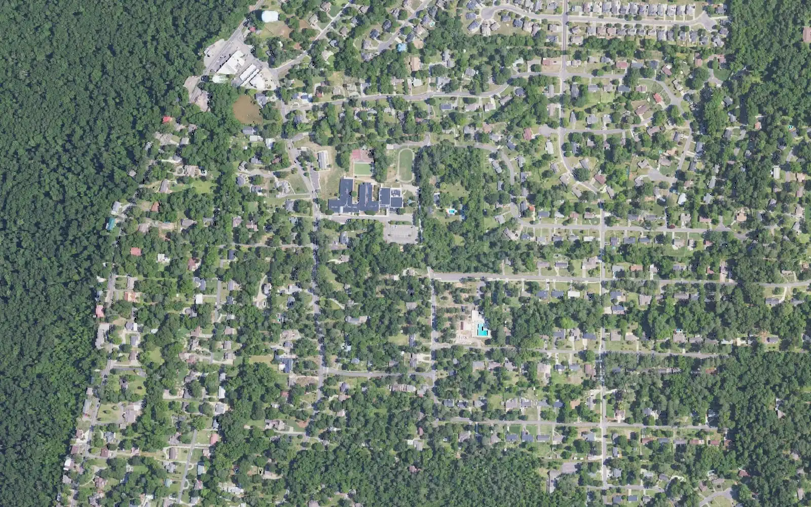
Bluff Park is the community on top of Shades Mountain, on Hoover’s north side. The city’s comprehensive plan names it on its map of the mountain and describes the view from Lover’s Leap in Bluff Park. It is mostly single-family homes on wooded, hilly streets, with Shades Crest Road along the ridge and Park Avenue and Tyler Road running through it.
What this means for you
- Zoned high school: Hoover High, 1000 Buccaneer Drive (2025 state report card: 84, a B).
- Home value: $436,667 in ZIP 35226 in September 2026, according to the Zillow Home Value Index.
- Nearest interstate exit: I-65 exit 254 (Alford Avenue), about 3 miles by road.
Part of our Hoover neighborhoods guide.
Where it is
On this page Bluff Park is the Bluff Park Elementary attendance zone on the district’s map, which covers the top of the mountain around the school at 569 Park Avenue. OpenStreetMap places Bluff Park at the same spot. In the school system’s parcel layer (2023 county tax records) the zone holds 5,937 parcels inside Hoover, every one in ZIP code 35226 and in Jefferson County. About 55% are filed under the county’s Bessemer Division and 45% under its Birmingham Division, which decides which courthouse office handles the tax bill.
The Bluff Park Community Organization is on the city’s list of neighborhood associations. The comprehensive plan puts the steep west face of Shades Mountain in its preserved open space category and says the Freshwater Land Trust controls significant acreage there.
Schools
Scores are each school’s overall score on the 2025 state report card (the 2024-25 school year).
| Level | School | Address | 2025 score (grade) |
|---|---|---|---|
| Elementary | Bluff Park Elementary | 569 Park Avenue | 99 (A) |
| Middle | Simmons Middle | 1575 Patton Chapel Road | 92 (A) |
| High | Hoover High | 1000 Buccaneer Drive | 84 (B) |
Homes on the western slope fall in the Deer Valley Elementary zone (Deer Valley Elementary, Bumpus Middle and Hoover High). The district says its map is for information only, so check one address with the School Locator Map and Student Services, 205-439-1016. More in our schools guide.
Home values
The typical home value in ZIP code 35226 was $436,667 in September 2026, up 2.9% from $424,281 in September 2025, according to the Zillow Home Value Index. The index is a modeled typical value for the middle third of homes, not a sale price. ZIP 35226 also covers The Preserve, Ross Bridge and other west Hoover neighborhoods, so it is not a Bluff Park figure alone. The citywide figure was $437,458, also up 2.9%. More in our home prices guide.
Parks and trails
- Bluff Park Community Park, 517 Cloudland Drive, has a public playground and restrooms. The private Shades Cliff Pool is on the same site, with memberships, according to the city’s park page.
- Moss Rock Preserve, the city’s 349-acre nature preserve with nearly 12 miles of hiking trails, is just south. One of its three trailheads is the lower parking lot of Simmons Middle, 1575 Patton Chapel Road, according to the city’s directions and parking sheet (PDF).
More in our parks and trails guide.
Getting around
- Interstates: I-65 exit 254 (Alford Avenue) is about 3 miles by road from the middle of the area, and exit 252 (U.S. 31, Montgomery Highway) about 3.7 miles.
- City Hall: about 4.4 miles by road to Hoover City Hall, 100 Municipal Lane.
- Airport: about 15 miles by road to Birmingham-Shuttlesworth International Airport. Distances are measured on the OpenStreetMap road network with the OSRM routing engine; they are distances, not drive times.
- Buses: no MAX Transit route runs through Bluff Park. The nearest stops in MAX Transit’s schedule data are on Route 3 (Jefferson Wenonah) along Wenonah Oxmoor Road, about 1.8 miles away in a straight line.
The comprehensive plan says local streets in the Bluff Park and Shades Mountain area are more interconnected than in Hoover’s newer suburbs, which spreads traffic across more routes. More in our getting around guide.
Groceries and everyday stores
From OpenStreetMap:
- Piggly Wiggly, Tyler Road.
- CVS Pharmacy, 2201 Tyler Road.
The larger shopping centers are down the mountain on U.S. 31 and around the Riverchase Galleria.
How we drew this area
The area is the Bluff Park Elementary zone on the Hoover City Schools map, which matches where OpenStreetMap and the city’s comprehensive plan put Bluff Park. Parcel counts and ZIP codes come from the parcels the school system’s map carries, checked Oct. 17, 2026. Place and store locations are © OpenStreetMap contributors.
Frequently asked questions
What schools is Bluff Park zoned for?
Every parcel in the Bluff Park Elementary zone is zoned for Bluff Park Elementary, Simmons Middle and Hoover High in the Hoover City Schools zone map. On the 2025 state report card they scored 99, 92 and 84.
What ZIP code is Bluff Park in?
- Zillow put the typical home value in 35226 at $436,667 in September 2026, up 2.9% from a year earlier.
Is Bluff Park part of Hoover?
Yes. Bluff Park is inside Hoover city limits in Jefferson County, and the city lists the Bluff Park Community Organization among its neighborhood associations.
Is Bluff Park a good place to live?
Here are the facts. Bluff Park is a Shades Mountain neighborhood with a city community park at 517 Cloudland Drive, zoned for Hoover High (84 on the 2025 state report card); the typical home value in ZIP 35226 was $436,667 in September 2026, according to Zillow.
Have your say