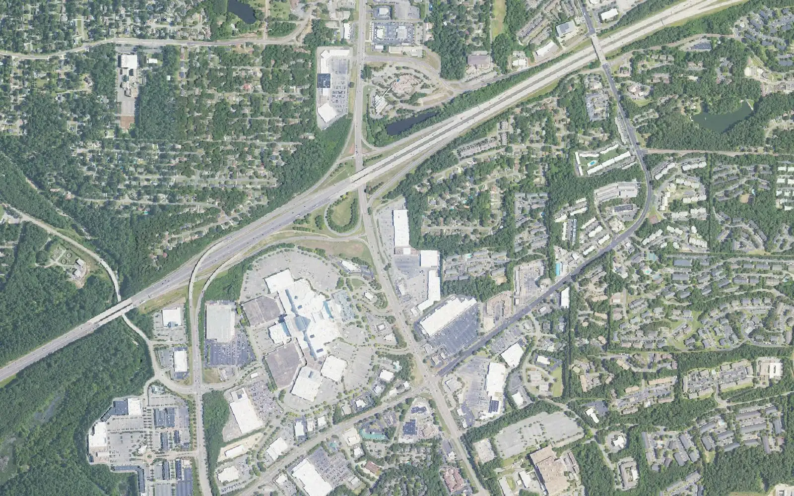
Ten Hoover areas, from Bluff Park to Greystone, with ZIP codes, zoned high schools and Zillow home values for September 2026. Hoover is in two counties.
Last checked Oct. 17, 2026. Sources: the City of Hoover’s Comprehensive Plan (PDF, 2019, amended 2020), neighborhood associations list and parks pages; Hoover City Schools’ School Locator Map and its parcel layer; the Alabama State Department of Education’s state report card for 2025; Zillow Research; the Census Bureau; and OpenStreetMap.
Hoover is a city of 92,642 people, according to the Census Bureau’s 2020-2024 American Community Survey five-year estimates, and it is long and narrow. It stretches more than 20 miles from the Bessemer line in the southwest to Greystone in the east, across two counties. I-459 crosses the middle of the city, I-65 runs north to south through it, U.S. 31 (Montgomery Highway) is the old main street and U.S. 280 serves the eastern end. Shades Mountain rises along the north side, with Bluff Park on top, and the Cahaba River runs through the south.
Three things to know before you look at a listing:
- Two counties. Of the 66,590 parcels inside Hoover in the school system’s parcel layer (2023 county tax records), about 65% are in Jefferson County and 35% in Shelby County. The county decides who sends the tax bill and the rate: 72.6 mills on the Jefferson side and 66.5 on the Shelby side in the state’s 2025 table. See our property taxes guide.
- ZIP codes do not follow the city line. Most of Hoover is in 35226, 35244, 35242 and 35216, but 35242 carries a Birmingham mailing address and 35216 is shared with Vestavia Hills. Some Hoover homes use 35022, a Bessemer ZIP code, and parts of Lake Cyrus and Inverness are outside the city altogether.
- School zones do follow the city line. Every home inside Hoover is served by Hoover City Schools, whichever county it is in. The district’s map has 11 elementary zones feeding two high schools: about 60% of Hoover parcels are zoned for Hoover High and 40% for Spain Park High. Check one address with the School Locator Map.
The areas at a glance
Home values are the Zillow Home Value Index for the area’s ZIP code in September 2026, a modeled typical value for the middle third of homes, not a sale price. Several areas share a ZIP code, so they share a figure. The citywide figure was $437,458, up 2.9% in a year.
| Area | ZIP code | County | Zoned high school | Typical home value in the ZIP |
|---|---|---|---|---|
| Bluff Park | 35226 | Jefferson | Hoover High | $436,667 |
| Lorna Road and Chapel Hill | 35216 | Jefferson | Split: Hoover High or Spain Park High | $409,889 |
| Riverchase | 35244 | Mostly Shelby | Spain Park High | $477,594 |
| The Preserve | 35226 | Jefferson | Hoover High | $436,667 |
| Ross Bridge | 35226 | Jefferson | Hoover High | $436,667 |
| Trace Crossings | 35244 | Jefferson | Hoover High | $477,594 |
| Lake Cyrus | 35244 | Jefferson | Hoover High (Hoover part) | $477,594 |
| Blackridge | 35244 | Shelby | Hoover High | $477,594 |
| Greystone | 35242 | Shelby | Spain Park High | $565,170 |
| Inverness | 35242 | Shelby, partly outside Hoover | Spain Park High (Hoover part) | $565,170 |
On the 2025 state report card, Hoover High scored 84 (a B), Spain Park High 90 (an A) and the district 95 (an A). Every elementary, intermediate and middle school in these areas scored 92 or higher.
The map
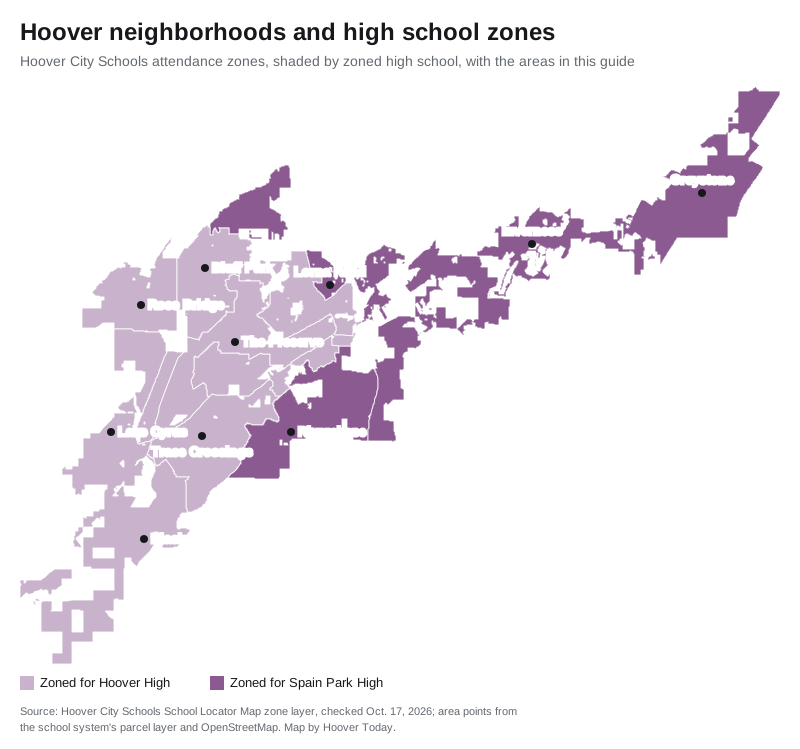
Zone shapes are from the Hoover City Schools zone layer; area points are © OpenStreetMap contributors and the school system’s parcel layer.
The areas
Bluff Park. The community on top of Shades Mountain, with wooded streets, Bluff Park Community Park on Cloudland Drive and a short drive to I-65. Zoned for Bluff Park Elementary, Simmons Middle and Hoover High.
Lorna Road and Chapel Hill. Aging shopping centers and apartments on Lorna Road that the city’s plan wants to remake as a “secondary downtown,” with Chapel Hill’s single-family streets beside them, near City Hall and Aldridge Gardens. MAX Transit Route 31 stops here. School zones split between Hoover High and Spain Park High.
Riverchase. The big planned community south of the Galleria, around the Riverchase Country Club and along the Cahaba River, mostly in Shelby County. Zoned for Riverchase Elementary, Berry Middle and Spain Park High.
The Preserve. A planned neighborhood on Preserve Parkway beside the 349-acre Moss Rock Preserve. Zoned for Gwin Elementary, Simmons Middle and Hoover High.
Ross Bridge. A planned community in west Hoover with a village center, golf course and resort hotel, named for a Civil War-era railroad bridge. Zoned for Deer Valley Elementary, Bumpus Middle and Hoover High.
Trace Crossings. The planned community around the Hoover Met Complex and Hoover High, a mile and a half from I-459 exit 10. Zoned for Trace Crossings Elementary, Bumpus Middle and Hoover High.
Lake Cyrus. A planned community at the western edge, partly in the City of Bessemer, with Brock’s Gap Intermediate inside it. The Hoover part is zoned for South Shades Crest Elementary, Brock’s Gap Intermediate, Bumpus Middle and Hoover High.
Blackridge. A planned community around Blackridge Lake in the Shelby County part of southwest Hoover, with 959 lots still to build in 2019, one of the largest counts in the city’s plan. Same schools as Lake Cyrus.
Greystone. The golf community off U.S. 280 at the city’s eastern end, in Shelby County. Zoned for Greystone Elementary, Berry Middle and Spain Park High.
Inverness. Lakes, a country club, office parks and shopping at U.S. 280 and Valleydale Road, split between Hoover and unincorporated Shelby County. The Hoover part is zoned for Greystone Elementary, Berry Middle and Spain Park High.
Comparing Hoover with its neighbors? See Hoover vs Homewood vs Pelham vs Vestavia Hills. More in our moving to Hoover, schools and home prices guides.
How we built this
We listed only areas that a source names and that we could place on a map:
- The City of Hoover’s 2019 comprehensive plan (amended 2020), which names Bluff Park, the Lorna Road Town Center and Chapel Hill, the Riverchase area, The Preserve, Ross Bridge, Trace Crossings, Lake Cyrus, Blackridge, Greystone and Inverness, and its neighborhood associations list.
- OpenStreetMap place names inside the city, © OpenStreetMap contributors.
- Hoover City Schools’ attendance zones and the parcel layer behind its School Locator Map, which give each area’s school zones, county and parcel count. Census ZIP code areas fill in ZIP codes where the parcel records leave them blank.
The plan also names smaller places, such as Lake Wilborn, Russet Woods and Southlake, that we did not give their own pages. Areas are described from public records only. We do not rank them.
Frequently asked questions
What are the neighborhoods in Hoover, Alabama?
Our guide covers 10 areas: Bluff Park, Lorna Road and Chapel Hill, Riverchase, The Preserve, Ross Bridge, Trace Crossings, Lake Cyrus, Blackridge, Greystone and Inverness.
What ZIP codes are in Hoover?
Mainly 35226, 35244, 35242 and 35216. Parts of Hoover use 35022, 35243 and others, and 35242 and 35216 carry Birmingham and Vestavia Hills mailing names in Zillow’s data, so a ZIP code is not proof of a Hoover address.
Is Hoover in Jefferson County or Shelby County?
Both. Of 66,590 Hoover parcels in the school system’s parcel layer, about 65% are in Jefferson County and 35% in Shelby County. Every home inside the city is served by Hoover City Schools, whichever county it is in.
Which high school will my Hoover address be zoned for?
Hoover High or Spain Park High. On the district’s zone map about 60% of Hoover parcels are zoned for Hoover High, mostly the west and center, and 40% for Spain Park High, mostly the east and Riverchase.
What is the typical home value in Hoover?
$437,458 in September 2026, according to the Zillow Home Value Index. By ZIP code it ranged from $409,889 in 35216 to $565,170 in 35242.
Have your say