Ross Bridge, a planned community in west Hoover, is zoned for Deer Valley Elementary, Bumpus Middle and Hoover High. ZIP 35226 was $436,667 in September 2026.
Last checked Oct. 17, 2026. Sources: the City of Hoover’s Comprehensive Plan (PDF, 2019, amended 2020) and capital projects list; Hoover City Schools’ School Locator Map and its parcel layer; the Alabama State Department of Education’s state report card for 2025; Zillow Research; MAX Transit schedule data; and OpenStreetMap.
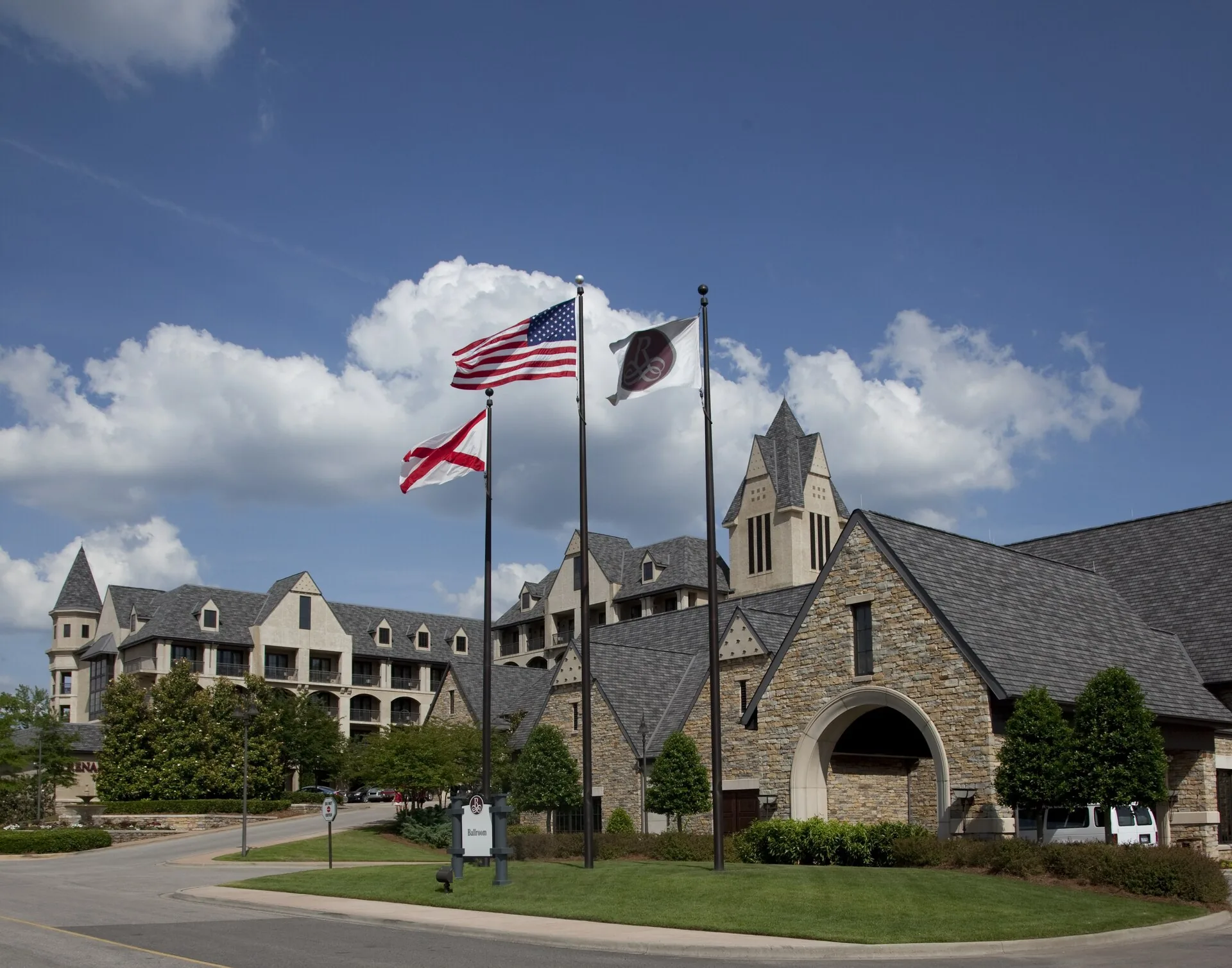
Ross Bridge is a planned community in west Hoover, on the west side of Shades Mountain and north of John Hawkins Parkway (AL 150), built around a village center, a golf course and a resort hotel. Hoover’s comprehensive plan lists it with Trace Crossings, Blackridge and Lake Cyrus as the planned developments behind the growth of west Hoover, and it names The Preserve and Ross Bridge as examples of shops and other non-residential uses built into a neighborhood.
What this means for you
- Zoned high school: Hoover High, 1000 Buccaneer Drive (2025 state report card: 84, a B).
- Home value: $436,667 in ZIP 35226 in September 2026, according to the Zillow Home Value Index.
- Nearest interstate exit: I-459 exit 10 (AL 150), about 5.2 miles by road.
Part of our Hoover neighborhoods guide.
Where it is
OpenStreetMap names Ross Bridge as a place in west Hoover, and Ross Bridge Parkway runs through it from AL 150. In the school system’s parcel layer (2023 county tax records), 1,166 parcels carry Ross Bridge in their subdivision name: the Village Center, Parcels D through I and the commercial phases. All but two are inside Hoover, all are in Jefferson County (filed under the county’s Bessemer Division) and nearly all are in ZIP code 35226.
The name comes from the Ross Bridge itself, which the comprehensive plan says was built during the Civil War as part of the rail network to the nearby Oxmoor coke ovens, which supplied iron to the war effort. The plan’s table of approved development counted 95 single-family homes and 10 townhouses still to be built in Ross Bridge as of March 30, 2019.
Schools
Scores are each school’s overall score on the 2025 state report card (the 2024-25 school year).
| Level | School | Address | 2025 score (grade) |
|---|---|---|---|
| Elementary | Deer Valley Elementary | 4990 Ross Bridge Parkway | 99 (A) |
| Middle | Bumpus Middle | 6055 Flemming Parkway | 94 (A) |
| High | Hoover High | 1000 Buccaneer Drive | 84 (B) |
Every Ross Bridge parcel falls in the Deer Valley zone on the district’s map. The district says the map is for information only, so check one address with the School Locator Map and Student Services, 205-439-1016. More in our schools guide.
Home values
The typical home value in ZIP code 35226 was $436,667 in September 2026, up 2.9% from $424,281 in September 2025, according to the Zillow Home Value Index. The index is a modeled typical value for the middle third of homes, not a sale price. ZIP 35226 also covers Bluff Park and The Preserve, so it is not a Ross Bridge figure alone. The citywide figure was $437,458, up 2.9%. More in our home prices guide.
Parks and trails
OpenStreetMap maps Ross Bridge Historical Park on the community’s east side and several small neighborhood parks inside it, among them Sawyer Trail Park, Butler Springs Park and Ross Park. The city does not list them on its parks pages.
The comprehensive plan proposes a multipurpose path linking Ross Bridge with Moss Rock Preserve, the Blackridge and Trace Crossings areas and the Freshwater Land Trust’s land along Shades Creek, as part of its West Hoover corridor. It has no date. More in our parks and trails guide.
Getting around
- Interstates: I-459 exit 10 (AL 150) is about 5.2 miles by road from the village center.
- City Hall: about 9 miles by road to 100 Municipal Lane.
- Airport: about 17 miles by road to Birmingham-Shuttlesworth International Airport. Distances are measured on the OpenStreetMap road network with the OSRM routing engine; they are distances, not drive times.
- Buses: no MAX Transit route serves Ross Bridge. The nearest stops in MAX Transit’s schedule data are on Route 3 (Jefferson Wenonah), about 2.7 miles away in a straight line.
Exit 9 is coming. The comprehensive plan proposes extending Ross Bridge Parkway south from AL 150 to Morgan Road, with a new I-459 interchange, Exit 9, as a parallel route to South Shades Crest Road. The city’s capital projects list shows the Exit 9 interchange design complete and the job set for bidding in 2027. More in our getting around guide.
Groceries and everyday stores
OpenStreetMap maps a pharmacy on Grand Avenue in the village center. The nearest supermarkets in its data are 2 to 2.5 miles away in a straight line: Publix, 2860 Lakeshore Parkway, and Target, 5561 Grove Boulevard, in The Grove Shopping Center on AL 150.
How we drew this area
The area is the land OpenStreetMap names Ross Bridge and the parcels in the school system’s parcel layer whose subdivision name begins with Ross Bridge, checked Oct. 17, 2026. The city’s comprehensive plan names it as a planned development. Place and store locations are © OpenStreetMap contributors.
Frequently asked questions
What schools is Ross Bridge zoned for?
Deer Valley Elementary, Bumpus Middle and Hoover High. Every Ross Bridge parcel in the school system’s parcel layer falls in the Deer Valley zone; the schools scored 99, 94 and 84 on the 2025 state report card.
Why is it called Ross Bridge?
For a railroad bridge built during the Civil War as part of the rail network serving the nearby Oxmoor coke ovens, according to Hoover’s comprehensive plan.
What ZIP code is Ross Bridge in?
- Zillow put the typical home value in 35226 at $436,667 in September 2026, up 2.9% in a year.
Is Ross Bridge a good place to live?
Here are the facts. Ross Bridge is a planned community of about 1,160 parcels in west Hoover with a village center and golf resort, zoned for Hoover High (84 on the 2025 state report card); the typical home value in ZIP 35226 was $436,667 in September 2026, according to Zillow.
Have your say